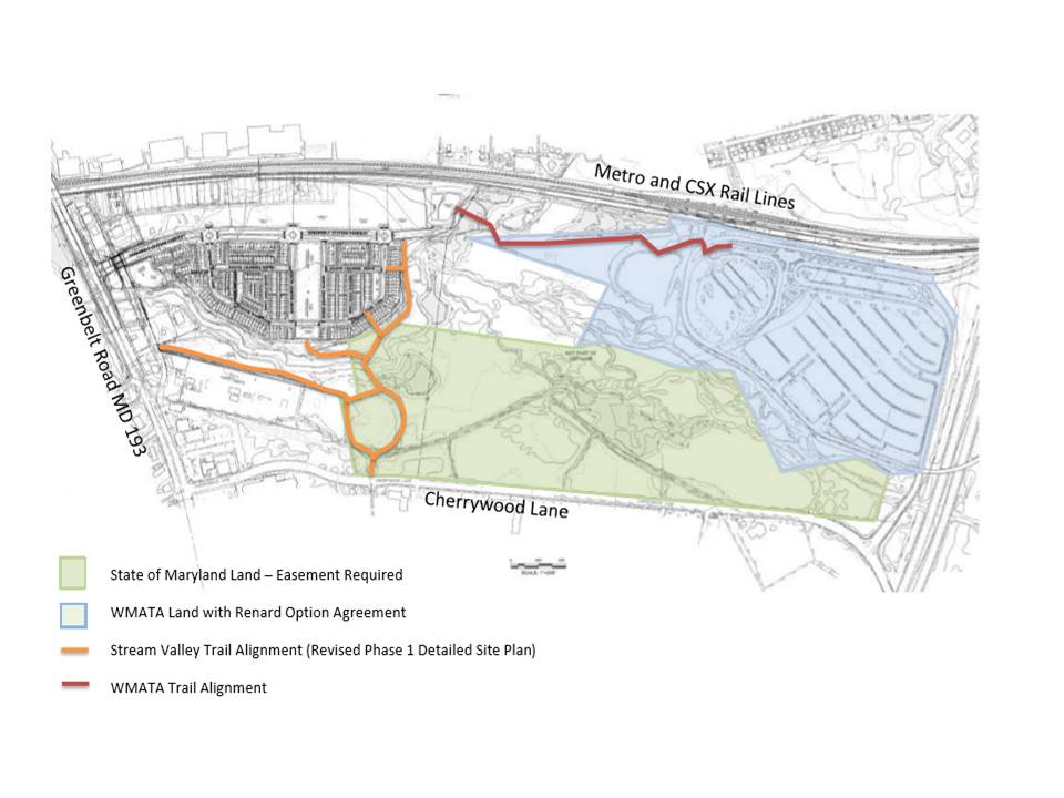
At a March 21 Greenbelt City Council worksession, Mayor Emmett Jordan was clearly upset over the information that efforts to construct a connecting trail between the South Core of Greenbelt Station, now well under development, with the Greenbelt Metro Station were put on hold by the Metro staff. The new development could be within easy walking distance of the station, but existing wetlands and vegetation prevent this from being done. The proposed path would have overcome these obstacles. The path would be temporary until such time as Greenbelt Station Parkway, the connector road that will run from Greenbelt Road through the South and North Cores of the Greenbelt Station development and interchange with the Beltway, is built. To view a larger version of the map, click on the small version.
That road will then provide pedestrian and bicycle access to the station from the South Core. For details on the controversy, read the story in the paper…